VMap is an enterprise web platform designed for asset surveying and monitoring within the Mobility and Smart Cities sectors.
VM stands out for its integration of AI-driven technologies, allowing to efficiently process both offline and live-streamed data from camera devices. One of its strengths is the use of multiple AI models for object recognition and geolocation, enabling high-accuracy detection and mapping of assets in real time. This makes it particularly well-suited for urban planning, infrastructure management, and smart transportation systems.
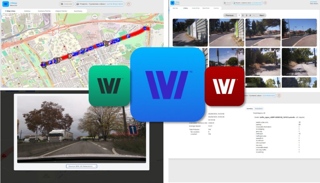
Key Features
• Collects geolocated images from camera devices into recordings (supports both photo or video formats);
• Processes the object detections from each recording using a multi-model approach;
• Enables viewing and analyzing captured data and multi object detections on GIS maps, photo galleries and data tables
- Checks the recording’s geolocated objects and pictures on map
- Visualizes in gallery the recording’s images with multi-detections
- Summarizes each recording with duration, number of pictures, number of object detections;
• Integrates user evaluation feedback to improve model annotation and training;
• Groups recordings by surveying projects.
Register here and request a trial.